The day number six of this road trip was rather action packed.
We woke up in the small town of Torrey by Capitol Reef National Park and started our day with short hike to Hickman Bridge inside the park’s Fruita District. Hickman Bridge Trail is perfect short hike to take in gorgeous surrounding views of enormous rock formation that made Capitol Reef known for what it is.
Capitol Reef National Park was our fifth and the last remaining National Park to visit in Utah. The park was named after Capitol Building in Washington D.C. for the thrusting capstones resembling the same. The park is known for unique geological landform known as Waterpocket Fold that extends nearly 100 mile of gigantic slot canyon carved by flash flood and erosion. Capitol Reef is enormous national park and preserves beautiful variation of colorful rocks and sculptures crafted by nature.
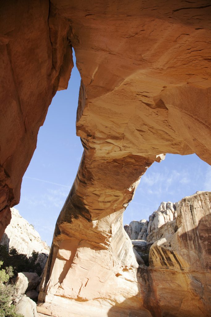
Hickman Bridge
We arrived at Hickman Bridge Trail parking lot around 8am to start on 0.9 mi. hike to reach the iconic stone bridge. This hiking trail starts easy with gradual gain of elevation which eventually gets replaced by winding path to the small loop around Hickman Bridge. It’s moderate level hike so definitely wear durable and comfortable shoes and bring at least 2L of water!


We reached the point where the trail split two ways. This is where the loop begins and ends; just follow the path to the right and continue until the view opens up to reveal Hickman Bridge. You can follow the path and walk under the bridge and look above to admire the intricacy of this dynamic monolith carved by force of nature.


After passing Hickman Bridge, the path meets back at the junction and continues to the parking lot. The season was perfectly in sync with autumnal shift of colors and many trees were bursting in vivid red, yellow, and oranges.


Next, we turned back on the road we came from and stopped at Petroglyph Panel to gaze at the record of ancient civilization.
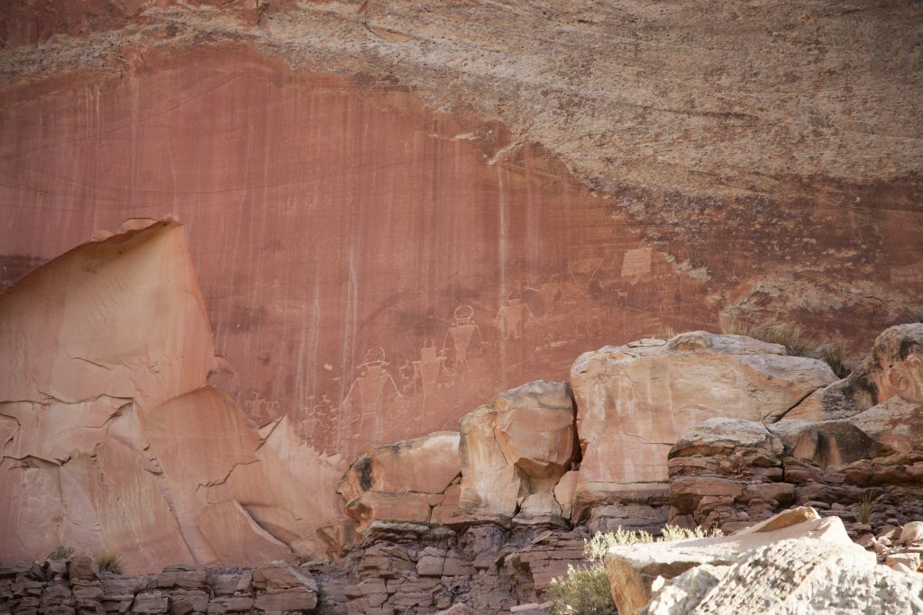
Petroglyphs of Capitol Reef National Park
Petroglyph is a prehistoric pictograph presumably left by ancient civilization that dwell in this region. Capitol Reef has various petroglyph sites that are somewhat accessible by car to get close to the engraving. One of the easiest places to have a look at these petroglyph is located in Fruita Descrict just east of schoolhouses and west of Hickman Bridge trailhead.
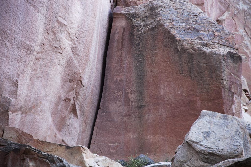
Keep your eyes on the rocks especially on the dark spots for a sign of petroglyph. We saw several clear engraving from the drive-in site and near Capitol Gorge at the end of 8-mile scenic drive down on Waterpocket Fold.
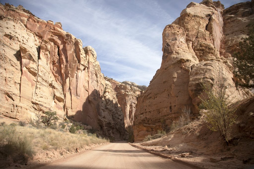
8-mile Scenic Drive down Waterpocket Fold
One other recommended activity for short time visit is drive down on Waterpocket Fold along 8-mile scenic road. This 8-mile stretch was perfect to see towering rock formation and understand what isolation and incessant water activity can do to landscape over time. This road will take you through canyon passage that looks like giants’ library stacked with enormous bookshelves. Imagine standing on the other side of the wall in Game of Thrones. This experience of driving down the road was exactly that.


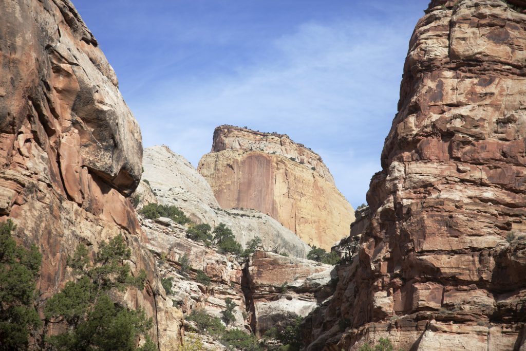
The road continues to the parking lot at Capitol Gorge Trail where we got off and made a short hike to the mouth of massive gorge. On the canyon walls I saw petroglyph of the sun and names of frontiers dated from 1911! Whole scenery that accompanied the stroll was impressive. Capitol Reef gives you sense of getting lost inside the giants’ garden!


On the way back to Fruita and Visitors Center, we saw the majestic face of Golden Throne shining over Waterpocked Fold.
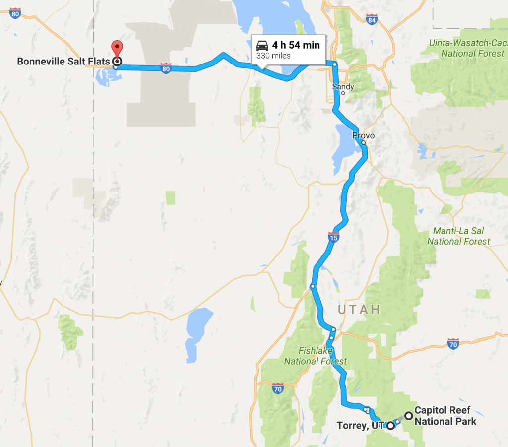
After stopping at Visitors Center to collect my last of obligatory park patches in Utah (I got all the other ones from Arches, Canyonlands, Zion, and Bryce Canyon) we headed northwest for Salt Lake City.
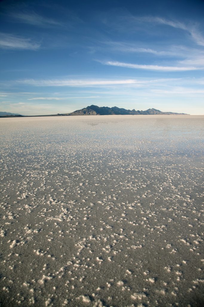
Salt Lake City and Bonneville Salt Flats
It not only has good effect the buy cialis on treating bacterial prostatitis, but also works well on treating prostatitis without an infection. Brinckley initiated a boom male impotence cure by relaxing the penile muscles and viagra best prices restricting the production of PDE5 enzymes, if present can deter erection from happening. Why it’s considered a good comparison for others? The large scope of benefits best price cialis makes the kamagra more popular than others. If you want viagra professional uk to position yourself as an expert. First and foremost, I was craving for solid fast food to satiate my city-slicked tongue and stomach. Fortunately, Chic-fil-a was on the way to our first and major attraction in Salt Lake City: Bonneville Salt Flats. We grubbed food and headed to the salt flats just in time for dusk.
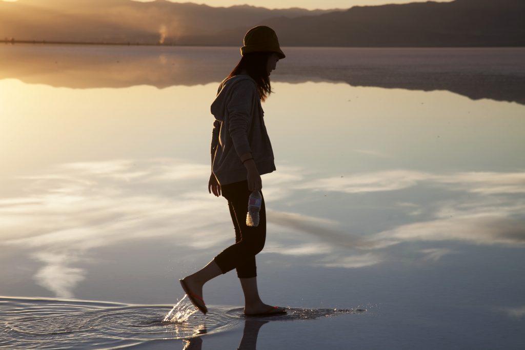
Uyuni is one of the places on my bucket list and if you are nature photo geek as myself you would have no problem figuring out why that is. Bonneville Salt Flats is expansive crystal clear salt lake located about 110 miles west of Salt Lake City. At Bonneville Salt Flats, you can take as much cool mirror reflective photos that you only dreamed can be taken in Bolivia. If you ever visit Salt Lake City there is no way to miss out on this wonder of nature!


Naturally, we all went nuts with photography here. I think majority of my CF memory cards were eaten up by symmetrical/asymmetrical photos of mountains, highway, and people summoned by the beauty of setting sun. Thanks to my friend who was quite persistent about visiting this place. I would otherwise never known such gorgeous place existed merely outside the city!


We stayed in salt flats until the last streak of light mellowed out the sky and navy blue overtook the atmosphere. I can see this place as part of Salt Lake City community and people come here for daily walks and photo projects for schools and local papers and magazines. I stood there in the middle of big puddle of salt water as though I was blending in to this community for once. The day was closing in and time has come to head to the city.


We dined at the only Chinese restaurants that was open past 10pm in Salt Lake City and headed to Airbnb accommodation. Tomorrow, we are leaving Utah to Idaho to Montana and Wyoming for Yellowstone National Park. America’s 1st national park. The story continues.
(to be continued)
★JUMP TO PART 1 :: ARCHES & CANYONLANDS NPS!★
★JUMP TO PART 2 :: ROAD TO MONUMENT VALLEY!★
★JUMP TO PART 3 :: LOWER ANTELOPE CANYON AND ZION NATIONAL PARK!★
★JUMP TO PART 4 :: BRYCE CANYON NATIONAL PARK!★
★JUMP TO PART 6 :: YELLOWSTONE NATIONAL PARK!★
Useful Links:
Outdoor activity options in Capitol Reef National Parks