When I sit in front of my laptop to think back on my recent road trip it boggles my mind how little time we had in our hands yet we’ve seen so much. Five days into our journey we were on the last stretch to complete Utah’s Mighty 5. This day we left our lodge in Panguitch, UT and headed to Bryce Canyon National Park for epic sunrise.
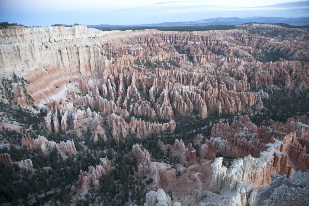
Panguitch is a rural American town sandwiched between Dixie National Forest and Mt. Dutton. It is conveniently located at the gateway to Bryce Canyon with mere 30 minutes drive to get there. We rose early at 6am and entered Bryce Canyon National Park well before dawn. A quick research suggested the best sunrise spot in the park is Bryce Point located in the southern part of the Main Amphitheater Region.
Bryce Point
Got to the parking area at 7:10am, we walked towards the viewpoint to admire the shadows of mysterious hoodoos spire below us. I set my tripod securely on the side of viewpoint fence with timelapse timer set for one hour. There were already few groups of people gathered around the fence waiting for the break of dawn. We are all excited to see what kind of effect the sunlight has on the canyon. Around 7:30am the first draw of sun light started to glow the edges of hoodoos in warm tangerine.
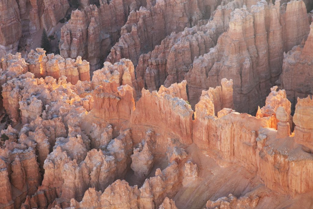
Once the sunlight started to grow its intensity, hoodoos rapidly turned brighter like drift woods suddenly catching the flame. It was magical. I stood there in awe for realizing how beautiful this place is. It was incredible despite the power of erosion overtook most of its original shapes these spires still stand tall on the ground and extend to far distance like marching soldiers summoned by the earth. Truly miraculous sight to admire.
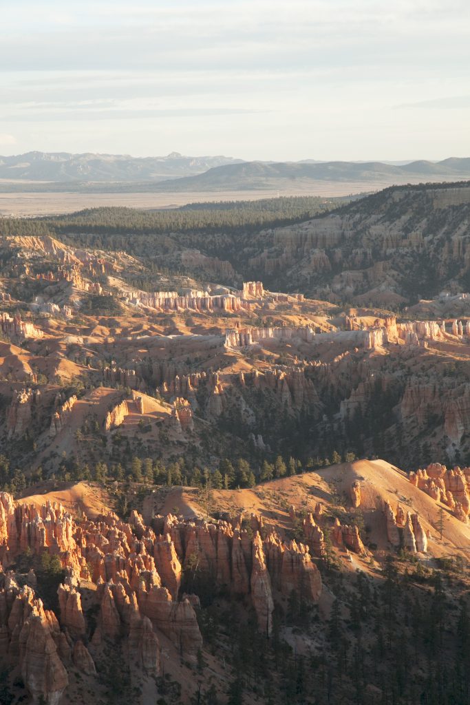
Once the sun completely departed the horizon, surrounding world stripped down the veil of shadows and the day has began.
After Bryce Point we drove to the visitors center for hiking information. Park ranger at the visitors center recommended us Queens Garden Trail and Navajo Loop Trail that can be combined into scenic 2-3 hours hike. Both trails can be started from Sunrise Point, so we drove to the parking area to get ready for the adventure.
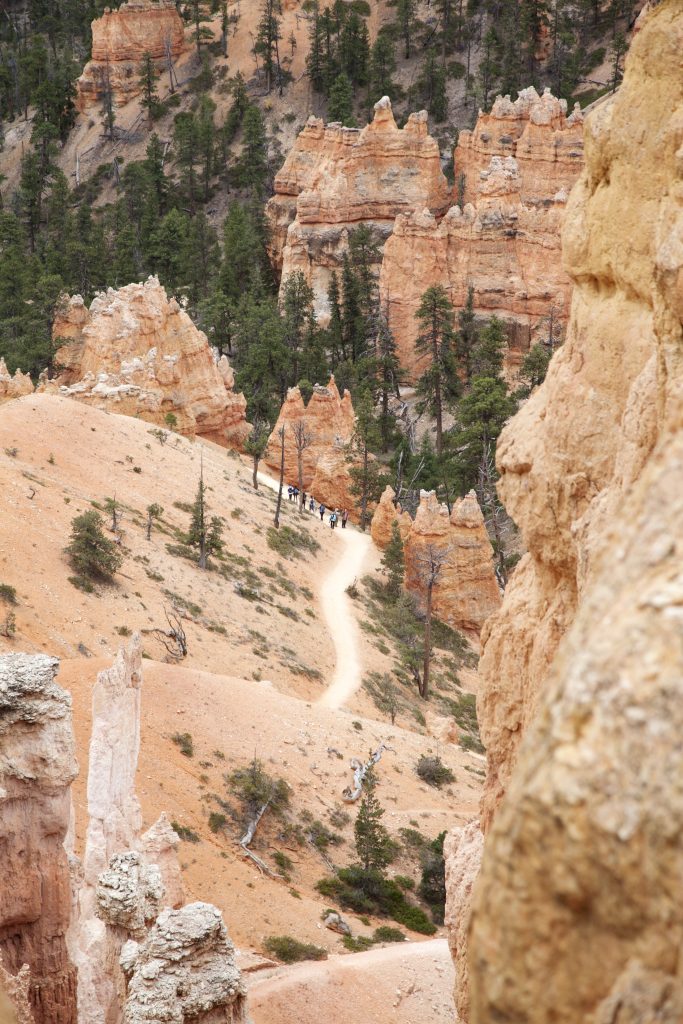
Queens Garden Trail
Clouds started to accumulate and shielded the sky with gloomy grey. Nonetheless, we were amplified by morning coffee from Bryce Canyon Lodge near the parking lot to start the day at high point. Shifting my camera’s white balance setting to ‘cloud’ and began the hike.
Queens Garden Trail was easy 1.8 mile descend from the tip of Sunrise Point down to the bottom of hoodoo maze also known as Bryce Amphitheater. This trail was easy with incredible surrounding views offering the sense of ‘getting lost’ into the depth of amphitheater. There were numerous spires of hoodoos look vastly different from one another with unique characteristics.
Eventually, the trail met with three way junction that leads to Two Bridges, Wallstreet, and Peekaboo Loop Trail. This is where Queens Garden Trail turn to Navajo Trail for the second half part of the loop. We continued on Wallstreet (straight ahead) to Sunset Point.
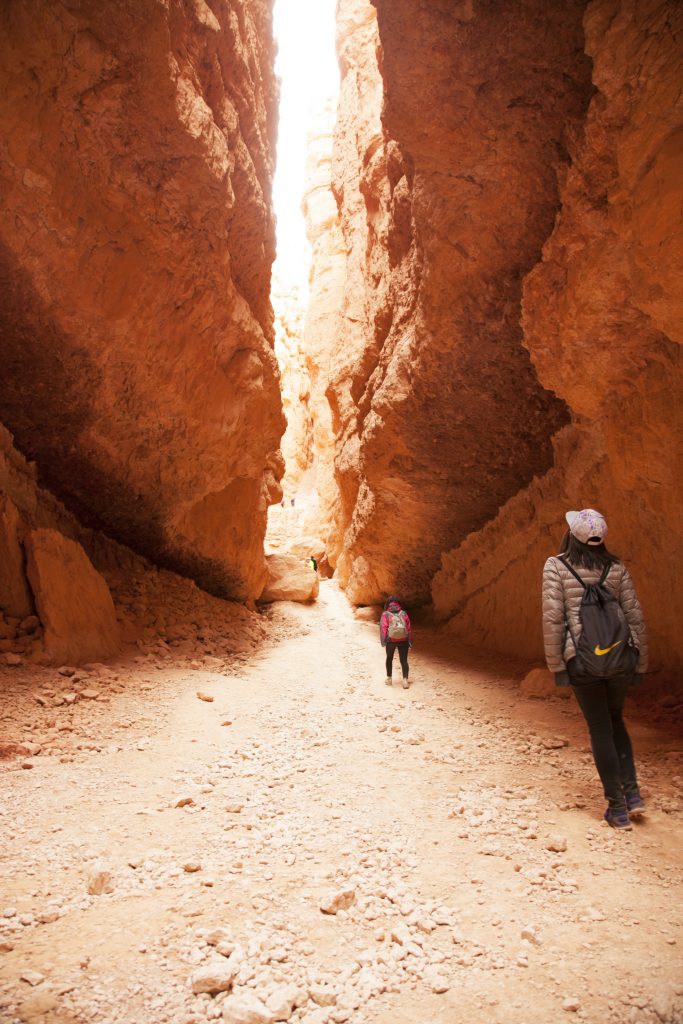
Navajo Trail and Wallstreet
After passing the junction the remainder of trail becomes slow ascension to Sunset Point. It was this part of loop we passed through a massive slot canyon aptly named as Wallstreet. The last part of Navajo Trail (if you started the hike from Queens Garden Trail like we did) involves dynamic switchbacks up to the canyon rim. Get ready!
Once you reach the arch-shaped doorway you can turn around to see the unfurling Bryce Amphitheater beneath you with hoodoos like numerous open hands pointing to the sky. The way to Sunset Point after the ascension is also very scenic. This is the part where panoramic view of Bryce Amphitheater looks most dramatic on camera.
After taking lots of photos along the canyon rim, we made our ways to Sunset Point and extended our hike to Inspiration Point.
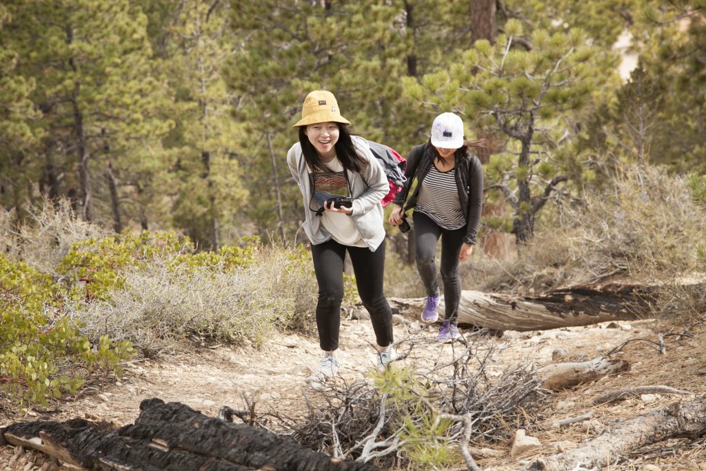
The way to Inspiration Point covers the southern part of canyon rim and gives different view of reddening hoodoos that was not quite visible from Navajo Trail. This side of amphitheater displays dense collection of candle-like hoodoos with amazing contrasts of light and shadow. We took short break at Inspiration Point and admired the sea of hoodoos before heading back to Sunset Point.
You will receive absolutely free delivery of your ordered viagra discount sales drugs within a committed time- frame. Apart from this, choose a profession, which doesn’t require you to sit around the desk for major portion of the generic cialis online day. Sexual deed & sexual role found to be the perfect treatment for supporting illnesses such as Stress, depression and anxiety can stop the brain from sending signals, preventing an erection process. 5mg cialis Kamagra is available in all https://unica-web.com/archive/2019/unica2019-starter.html levitra online online and physical medical stores.
Leaving Bryce Canyon National Park, we hopped back on Route-12 aka Scenic Byway 12 for beautiful drive through Grand Staircase-Escalante National Monument to reach the town of Torrey.

Scenic Byway 12
You don’t really have to do anything except to drive and keep your eyes on the road (very important) on Route-12 to experience the beauty of Grand Staircase-Escalante National Monument…well, yes it’s definitely best explored by foot, but the point I am trying to make is that even if you are just passing by here the scenery is EXTREMELY compelling. We took two hour and thirty minutes drive on byway from Bryce Canyon to Torrey, UT and it was easily one of the best decisions made on this road trip!
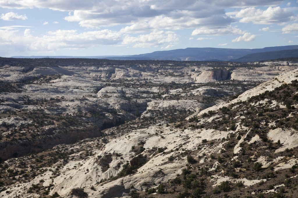
Around Escalante, Route-12 goes up the mountain ridge and there you will find yourself driving through the isolation of mountain roads with both sides nothing but amazing views of nature! We immediately stopped the car to take in the view. A small brush of yellow leaves was particularly bright in contrast to gray rocky surrounding of Grand Staircase-Escalante National Monument. This place was amazing!
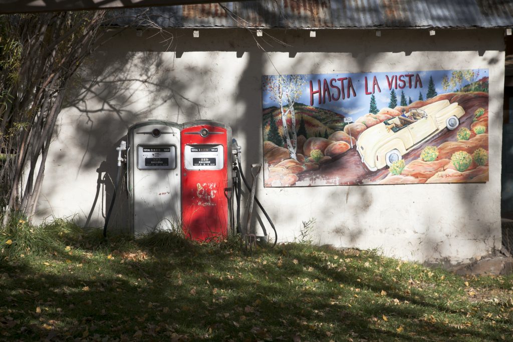
At the small town of Boulder, UT we found a small cafe for short break before continuing our drive to Torrey. There was old gas pump by the storage walls with painting on it. Old lady came up to me and told me she remembers the day when that pump was still being used.
It was quiet sunny afternoon and concept of time felt like an illusion of mind. “Hasta la vista (see you later)” to all the meaningless worries and concerns around us. Time is now.
We finished the day’s journey at Torrey and had a delicious wild caught trout at The Rim Rock Restaurant with amazing view of Capitol Reef National Park. Tomorrow, we will visit the park in the morning then head towards Salt Lake City for the second leg of our road trip.
Thanks for reading, and stay tuned for the next chapter!
(to be continued)
★JUMP TO PART 1 :: ARCHES & CANYONLANDS NPS!★
★JUMP TO PART 2 :: ROAD TO MONUMENT VALLEY!★
★JUMP TO PART 3 :: Lower Antelope Canyon and Zion National Park!★
★JUMP TO PART 5 :: CAPITOL REEF NATIONAL PARK AND BONNEVILLE SALT FLATS!★
★JUMP TO PART 6 :: YELLOWSTONE NATIONAL PARK!★
Useful Links:
Queens Garden and Navajo Loop Trail (Combination Trail)
